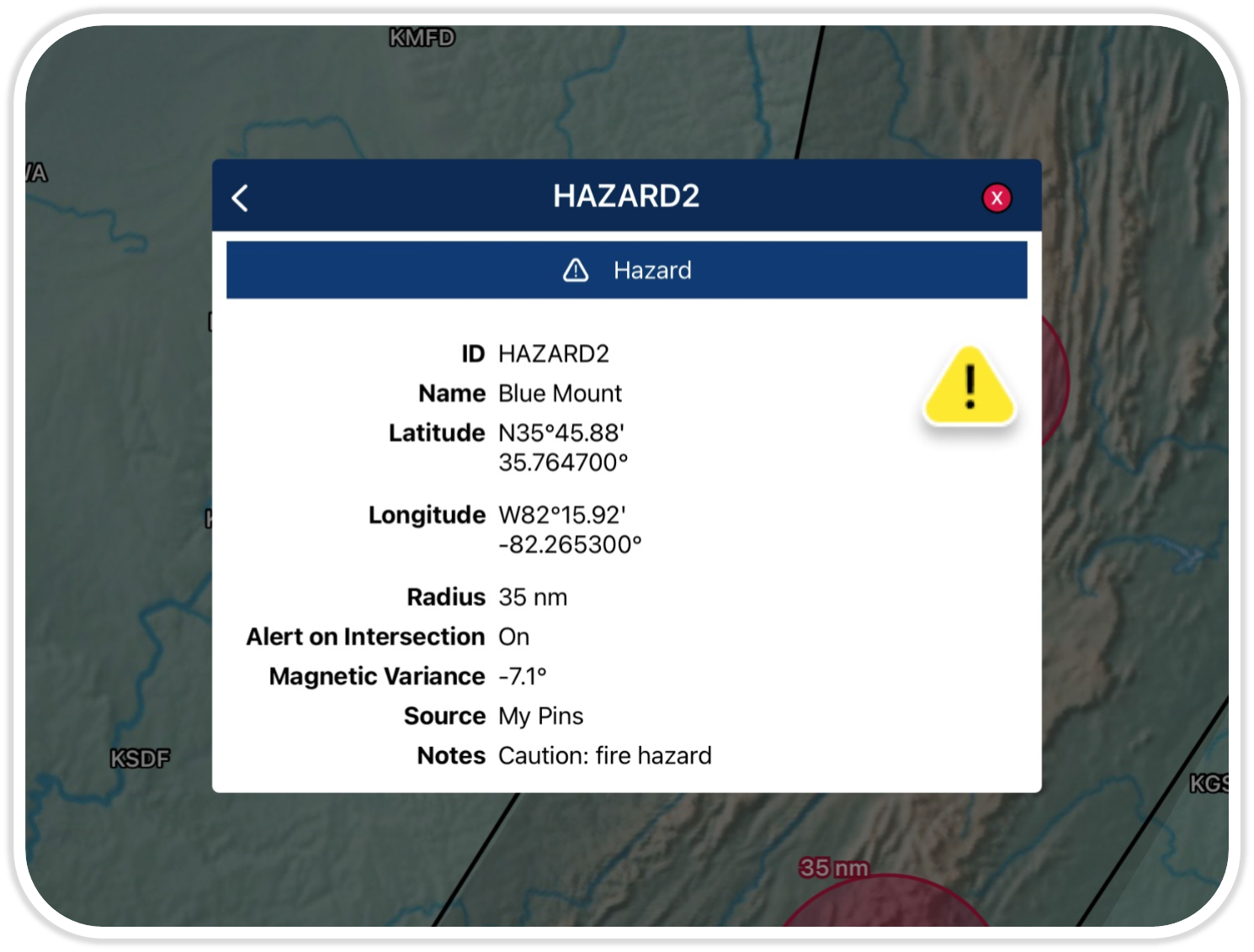
Hazards Icon ![]()
Aero App allows pilots to mark and identify potential dangers on the Moving Map. Drop hazards on the map to highlight areas that pose a threat and avoid them accordingly.
(Available on Aero App – iOS, Android)
Zulu Clock ![]()
Aero App Zulu Clock has enhanced the Flight Information Panel. This provides pilots with always-current coordinated universal time (UTC).
(Available on Aero App – iOS, Android)
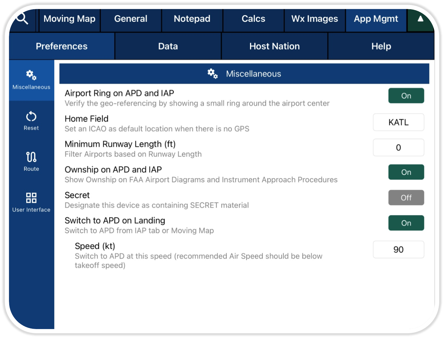
Home Field Setting ![]()
Aero App provides quick access to a pilot’s selected areas when there is no GPS. Home Field allows pilots to set an ICAO as their default location on the Moving Map.
(Available on Aero App- iOS, Android)
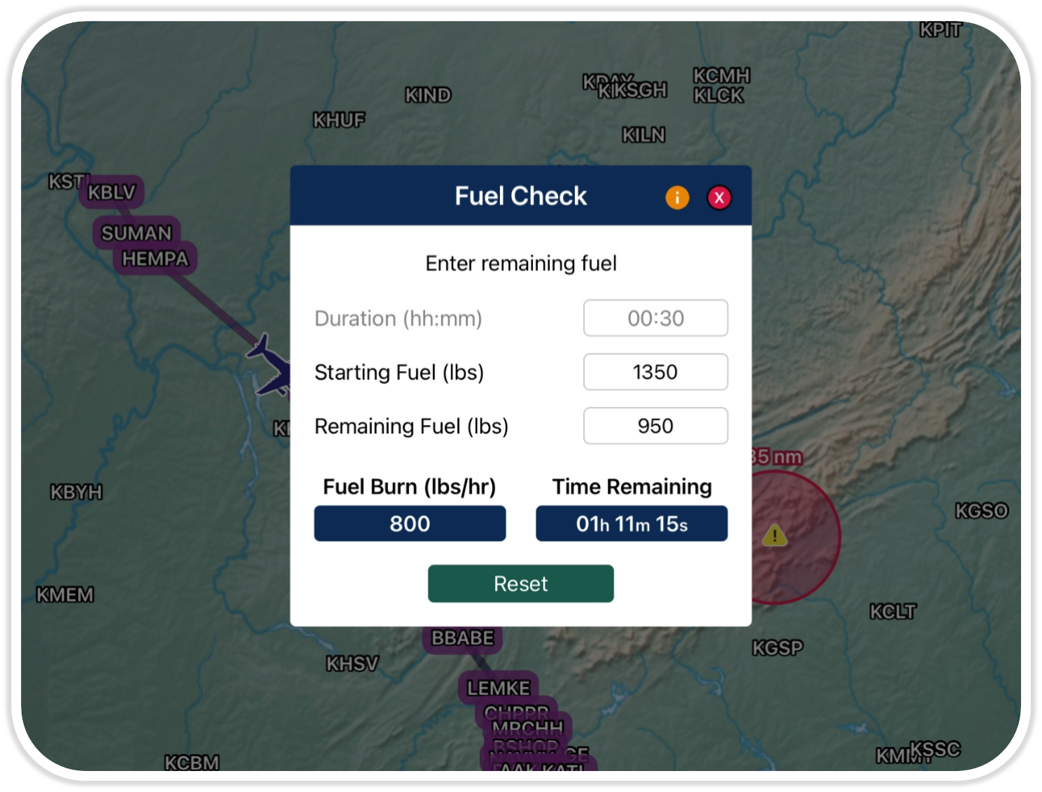
Fuel Check ![]()
Aero App’s fuel check enables pilots to calculate the fuel burn usage of their ownship. Pilots can monitor fuel consumption and estimate the required fuel.
(Available on Aero App – iOS, Android)
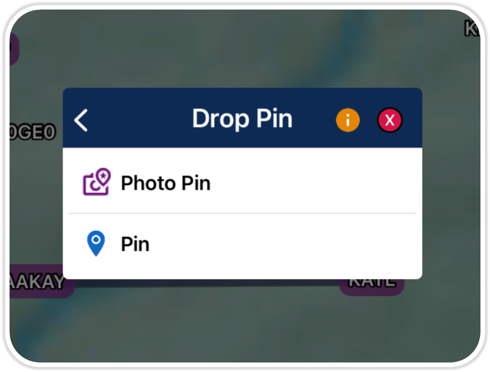
Photo on Moving Map ![]()
The photo pin feature allows pilots to incorporate user-generated images. This feature shows photo pins on the Moving Map.
(Available on Aero App – iOS, Android)
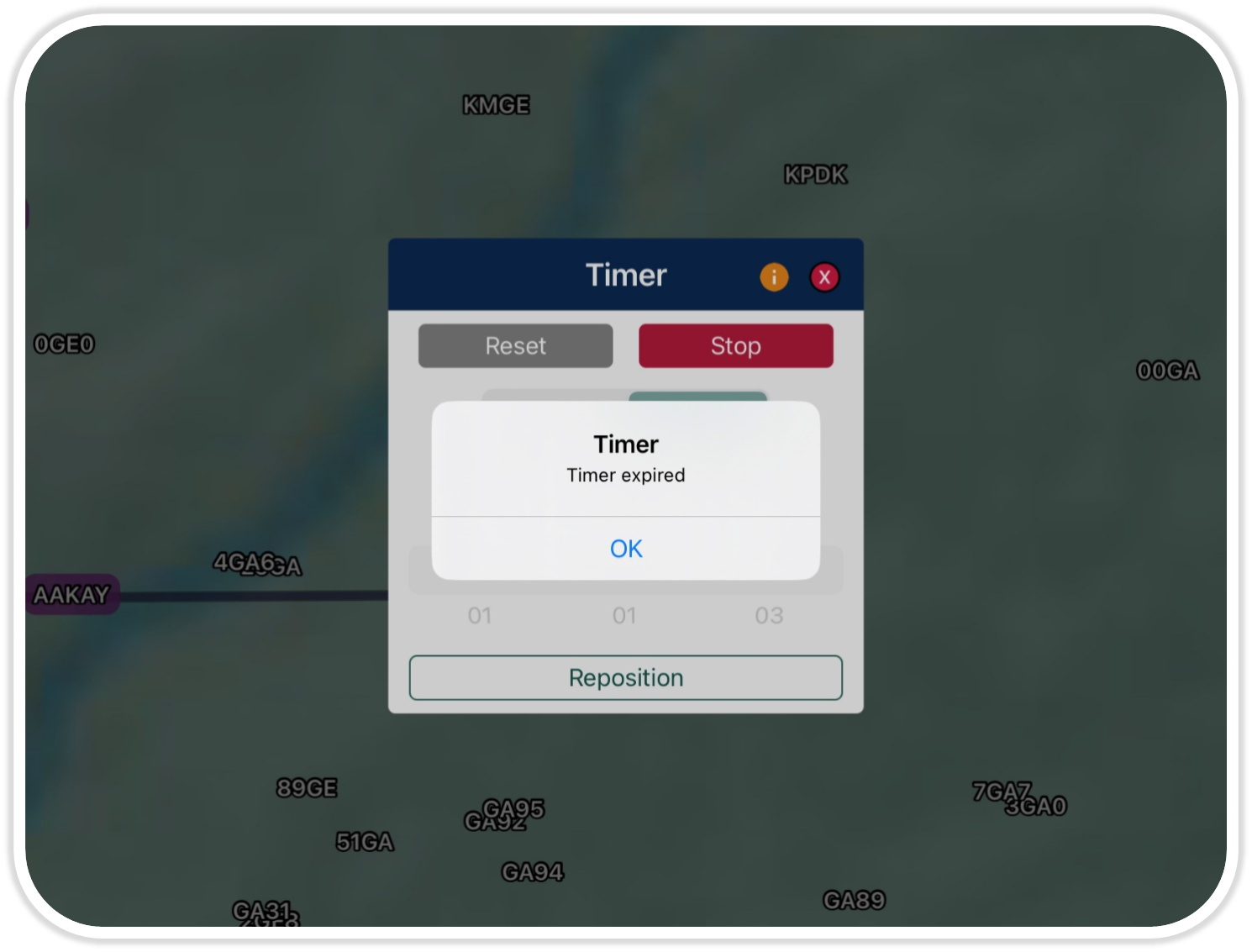
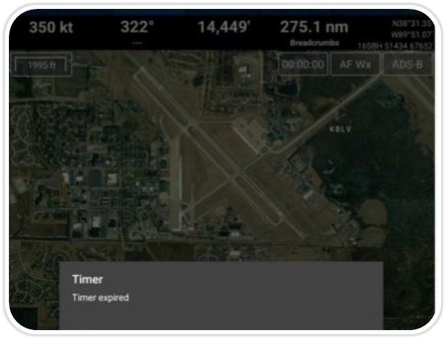
Timer Alerts ![]()
Aero App has enhanced the existing Timer feature by providing a notification system to alert the user before the timer expires. Pilots will receive notifications while their device is in use or while being locked.
(Available on Aero App – iOS, Android)
Multi-Tasking ![]()
Aero App supports multi-tasking capabilities which allows pilots to interact with different apps simultaneously in split screen view. Pilots can now complete tasks and switch between apps without interruption.
(Available on Aero App – iOS, Android)
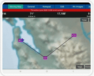
Moving Map Update
Aero App’s Moving Map has been enhanced to improve performance, for a more responsive and optimized experience.
(Available on Aero App – iOS)
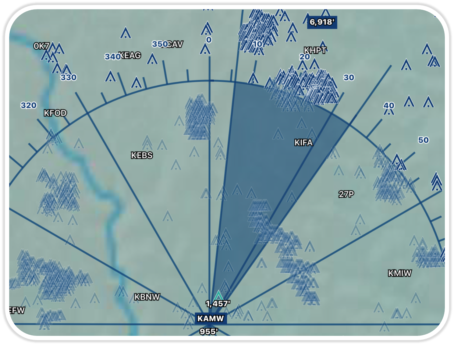
Line of Sight ![]()
Terrain and Vertical Obstructions data is used to calculate the minimum altitude to be able to fly over a given sector for Coverage, and to remain unobstructed from the orbit center in a given sector for Line of Sight.
(Available on Aero App- iOS)
Timer Alerts ![]()
Aero App has enhanced the existing Timer feature by providing a notification system to alert the user before the timer expires. Pilots will receive notifications while their device is in use or while locked.
(Available on Aero App – Android)

API to ATAK
ATAK users can now interface with Aero App to request data such as airport information and airport charts.
(Available on Aero App – Android)
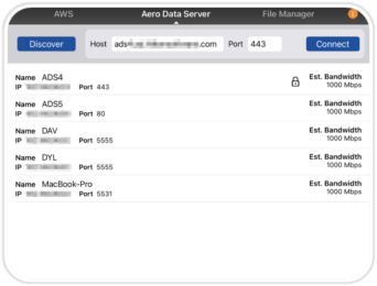
ADS Update ![]()
ADS Working Mode has been updated to Share with Devices to provide a simplified and easy-to-use data sharing experience for pilots.
(Available on ADS)
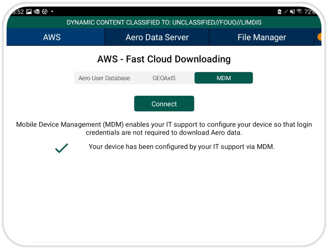
MDM Support ![]()
Mobile Device Management enables system administrators to automate and monitor many user devices. This allows for devices to be automatically authenticated, thereby negating the need for login credentials.
(Available on Aero App – iOS, Android)
Lat/Lon-MGRS Format ![]()
Aero App enables users to configure units to MGRS or Lat/Lon format. Additionally, pilots can select between km or nm as their preferred unit of measurement.
(Available on Aero App – iOS, Android)
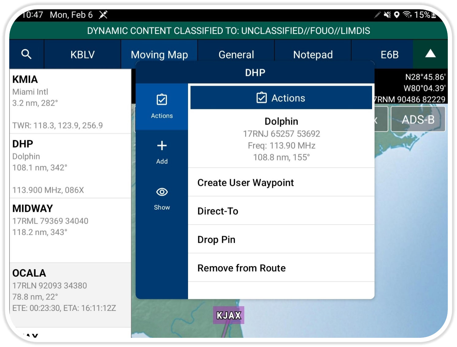
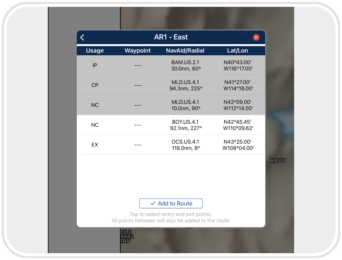
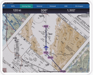
NavAid Overlay ![]()
Aero App displays NavAid information such as frequency, distance, and bearing from the ownship’s location. The pop up can be accessed from the Route Panel or Moving Map.
(Available on Aero App – iOS, Android)
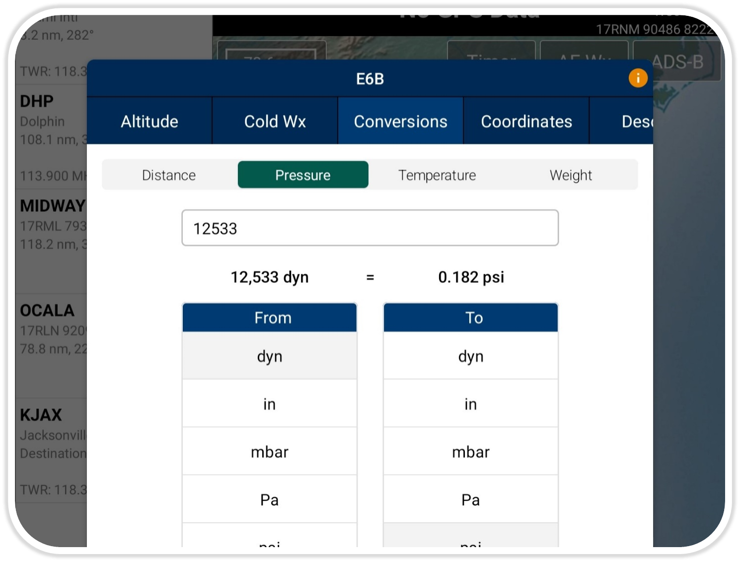
E6B Conversions ![]()
Aero App has extended E6B Conversions to include additional options. The conversions are sorted and categorized for an easy-to-use experience.
(Available on Aero App – iOS, Android)
Aero App for Android on Windows ![]()
Run Aero App for Android on Windows! Get Aero App for Android features such as the globe, moving map, and additional overlays on your Windows device.
Requires Windows 11
(Available on Aero App – Android)
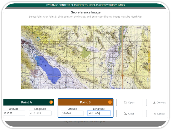
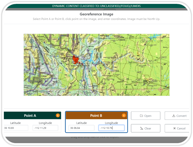
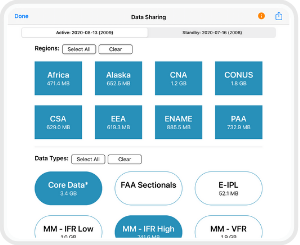
Georeference on ADS ![]()
Georeference on ADS enables users to georeference a PDF, PNG, or JPG image simply by selecting two points. Using this georeference information, ADS creates an MBTiles file which can then be used in Aero App.
(Available on ADS)
Map Library ![]()
Aero App allows users to download Map Library charts and display on the Moving Map. These charts are distributed by the Aero App team and include maps for emergencies, NavPlan charts, range charts, and others.
(Available on Aero App – iOS, Android)
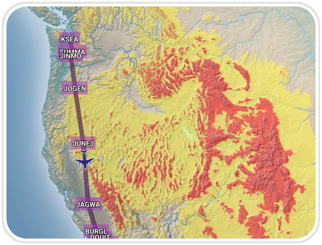
Terrain Coloring ![]()
Terrain Coloring provides excellent situational awareness for flight crews. Terrain Coloring is an inflight high-resolution map overlay whose dynamic altitude-based color system depicts the proximity of a pilot’s ownship relative to terrain.
(Available on Aero App – iOS, Android)
Background Downloading ![]()
Once a download begins, users can switch to a different page within or outside of Aero App and download will continue. This allows users to work on different views simultaneously.
(Available on Aero App- iOS, Android)
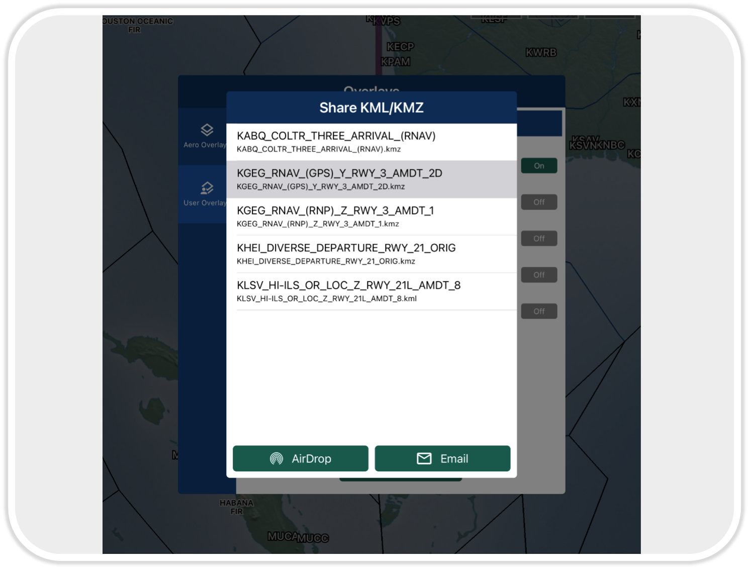
Share KML/KMZ Files ![]()
Aero App enables pilots to easily share KML/KMZ files for efficient mission planning. This feature enhances the collaboration of pilots by providing the ability to share and receive files through Nearby Share or Email.
(Available on Aero App – iOS, Android)
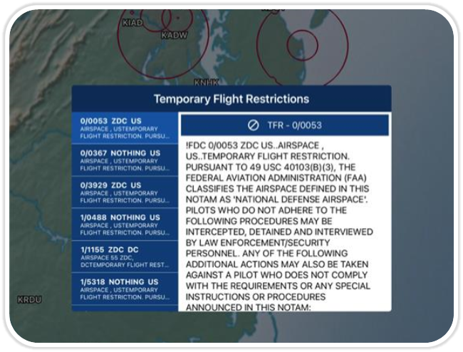
Temporary Flight Restrictions (TFRs) ![]()
Aero App has the ability to display graphical and textual TFR information on demand with the connection of cellular data, Wi-Fi, or an ADS-B receiver. Pilots have the ability to access up-to-date TFR data during their preflight or inflight experience.
(Available on Aero App – iOS, Android)
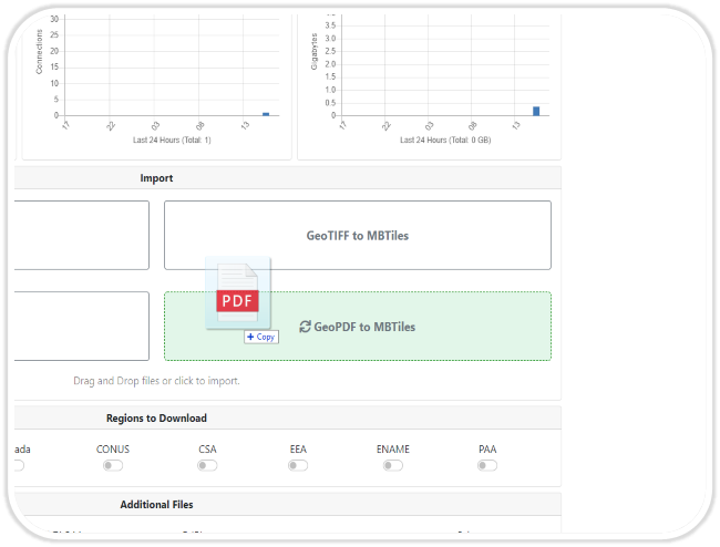
Convert GeoPDF to MBTiles ![]()
Aero Data Server has expanded its conversion capabilities and now enables pilots to convert GeoPDF files into MBTiles.
(Available on ADS)
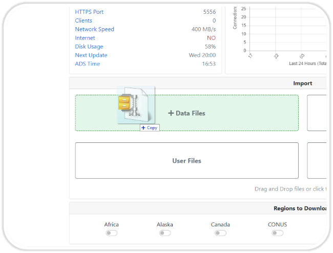
Drag and Drop ![]()
This feature enables pilots to drag and drop files directly into the Aero Data Server browser.
(Available on ADS)
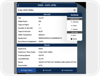
File Flight Plans ![]()
Aero App enables users to conveniently file ICAO flight plans. From the Route Panel, users can access previously filed flight plans, add or edit Aircraft information for ease of access when filing a new flight plan, and enter or update Flight Service credentials. This feature is available to FAA and DOD users.
(Available on Aero App – iOS, Android)
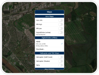
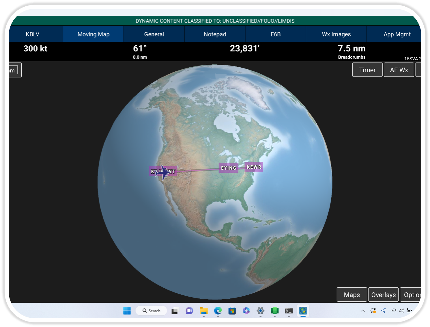
Digital Globe ![]()
Aero App displays online DigitalGlobe satellite imagery as the Base Map. This imagery can be stored and used later when offline.
(Available on Aero App – iOS, Android)

GEOAxIS OAuth Integration
Aero App provides a secure authentication process to pilots through the integration of GEOAxIS OAuth services.
(Available on Aero App and ADS)
![]()
IAP Transparency ![]()
Pilots have the option to adjust the transparency settings of Instrument Approach Procedures displayed on the Moving Map.
(Available on Aero App – iOS, Android, Windows)
Add Partial MTR to Route ![]()
Pilots can add Military Training Routes (MTRs) to their flight route as well as view MTRs on the Moving Map and Route Panel.
(Available on Aero App – iOS, Android)
Add KML Coordinates to Route ![]()
Aero App enables pilots to load KML coordinates to their route.
(Available on Aero App – iOS)
ADS HTTPS Integration ![]()
The implementation of ADS HTTPS Support provides users with additional security when downloading data on Aero App.
(Available on Aero App and ADS)
Air Refueling Routes ![]()
Aero App enables pilots to add Air Refueling Routes directly from the Route Panel. The Air Refueling Route will populate on the current route and on the Moving Map.
(Available on Aero App – iOS, Android)
Distance Rings ![]()
Aero App has enhanced the existing Distance Rings feature to allow pilots to better configure Distance Rings by setting a desired distance between rings – thus determining the number of rings displayed.
(Available on Aero App – iOS, Android, Windows)
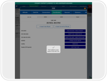
E6B Coordinates – Add to Route ![]()
Provides pilots the capability to add E6B coordinates directly to the route of flight.
(Available on Aero App – iOS, Android, Windows)
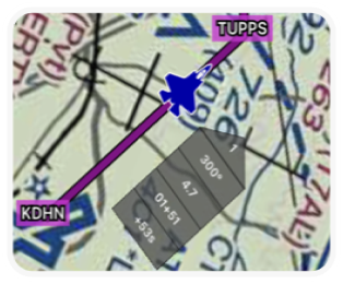
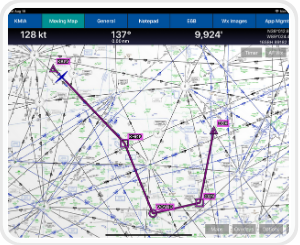
Doghouses ![]()
Pilots can enter Groundspeed, select Time on Target, and Doghouses will automatically adjust Estimated Time of Departure, Estimated Time Enroute, Estimated Time of Arrival, and even show pilots up to the second how ahead or behind they are on their Time on Target.
(Available on iOS, Android and Windows)
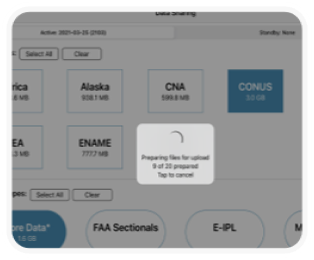
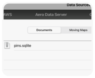
Upload to ADS ![]()
Pilots can now share Data Cycles, Maps, and additional files quickly and easily by uploading to ADS from Aero App.
(Available on iOS)
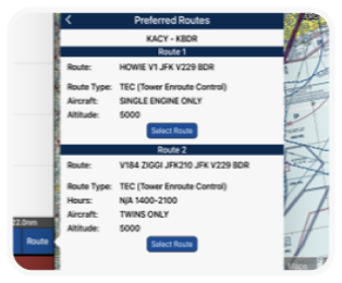
Preferred Routes ![]()
This feature allows for enhancement of a pilot’s current route by reducing unnecessary route and providing various options for new/revised direct routes. Pilots can select their choice of Departure Procedure (DP) or Standard Arrival Procedure (STAR) and add to their current route, with their new route displaying with a single tap.
(Available on iOS and Android)
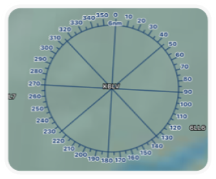
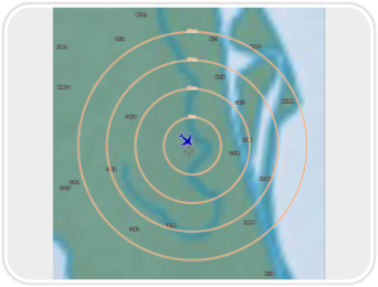
Enhanced Orbits
The existing Orbit feature has been enhanced for better pilot configuration. Pilots can now set their magnetic variance, modify the value of their rings, set the distance at their leisure, and much more. Pilots can also overlay a user-defined radius around a selected point on the Moving Map and can select the color and transparency option.
(Available on iOS)
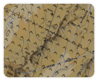
Mountainous Areas
Mountainous Areas are zones characterized by mountain ranges; these zones will be overlaid on the Moving Map over the United States and its territories.
(Available on iOS)
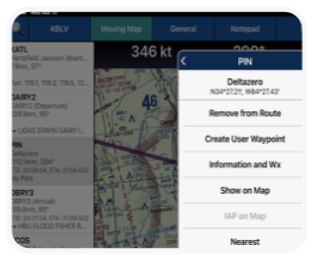
Add Pins to Route ![]()
Aero App enables users to drop Pins on the Moving Map to mark specific locations. Pins also contain other useful information like its unique Identifier, Name, Notes, and a photo. Pilots can search their pins by unique identifier and directly add them to their current route.
(Available on iOS and Android)
Export Pins
Aero App enables users to drop Pins on the Moving Map to mark specific locations. Users can now export and share pins with other users. Exported pins can be sideloaded and imported into Aero App with unique identifiers for each. Pilots have the ability to overlay loaded pins on the Moving Map and all dropped pins can be viewed from the Route Panel.
(Available on iOS, Android and Windows)
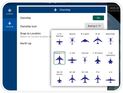
Ownship Icon ![]()
Pilots can select their preferred ownship icon to display on the Moving Map. Pilots can select from P-3 (B737), Boeing C-17, A-10 Warthog, and many more.
(Available on iOS)
Point Shapes ![]()
Pilots can add point shapes (triangles, squares, or circles) to the points in their route.
(Available on iOS and Android)
Drag and Drop Routes ![]()
Pilots can drag any segment or point of their current route and drop it to their desired point.
(Available on iOS and Android)
User Maps ![]()
Aero App enables users to load User Maps as their base Map.
(Available on iOS, Android and Windows)
AirDrop
Pilots can share files such as Data Cycles, Maps, and additional files with other iOS devices. AirDrop-compatible files are files that have not been created using delta files.
(Available on iOS)
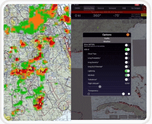
New ADS-B Products ![]()
Pilots can overlay ADS-B weather such as Cloud Tops, Icing Probability, Icing Severity, Icing SLD Potential, Lightning, NEXRAD, and Turbulence. Pilots can also change the transparency of the ADS-B weather overlay.
(Available on iOS, Android)
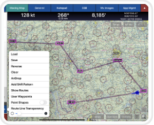
Route Line Transparency
Aero App allows pilots to adjust their current route line transparency.
(Available on iOS and Android)
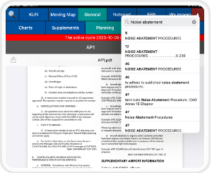
PDF Search
Pilots can search key terms on the body text of any PDF file within Aero App. The searched term will be highlighted in the current document.
(Available on iOS)
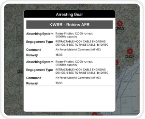
Arresting Gear
Aero App enables pilots to overlay worldwide Arresting Gear locations on the Moving Map. Tapping on an Arresting Gear icon displays a pop-up with relevant information.
(Available on iOS and Android)
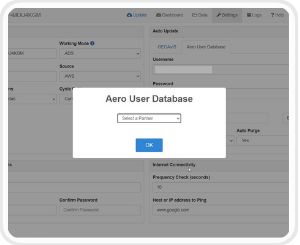
AUD Support on ADS
Aero Data Server allows the use of Aero User Database (AUD) credentials to download data.
(Available on ADS for macOS and Windows)
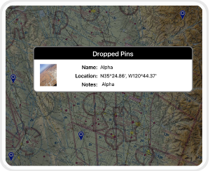
Drop Pins ![]()
Enables pilots to drop points in any specified area and view additional descriptive information about the point.
(Available on iOS, Android and Windows)
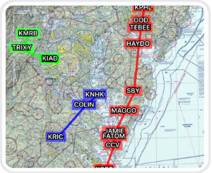
Show Multiple Routes
Aero App enables users to show multiple saved routes on the Moving Map simultaneously in different colors. The graphic depiction of multiple routes enables pilots to compare one or more routes.
(Available on iOS, Android and Windows)

Switch To APD On Landing ![]()
The Airport Diagram will automatically switches to the destination Airport Diagrams (APDs) on landing. Airport diagram will appear upon landing and slowing to match the switch-over speed.
(Available on iOS, Android and Windows)
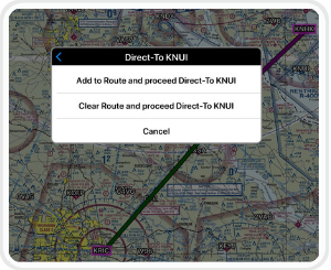
Direct-to
Direct-To enables users to create a route from their current location or modify an existing route to their desired Airport, NavAid, Waypoint, or Coordinate.
(Available on iOS, Android and Windows)
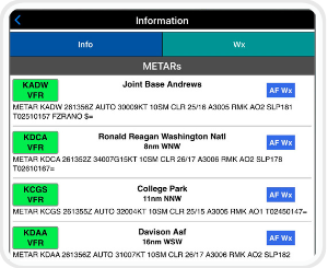
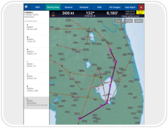
AF Wx ![]()
Aero App displays Air Force weather on the Moving Map and on the route panel.
(Available on iOS, Android and Windows)
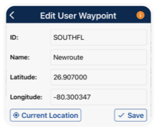
Renaming User Waypoints
Pilots can now rename their user waypoints with a unique identifier and name of their choosing. They can also tap to edit the latitude and longitude of a desired point.
(Available on iOS and Android)
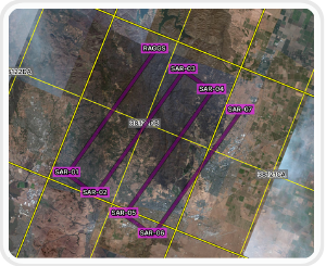
Search and Rescue Grids
Aero App displays world-wide Search and Rescue (SAR) Grids for pilots. Pilots have the ability to display search patterns directly on the Moving Map.
(Available on iOS, Android and Windows)
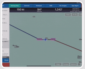
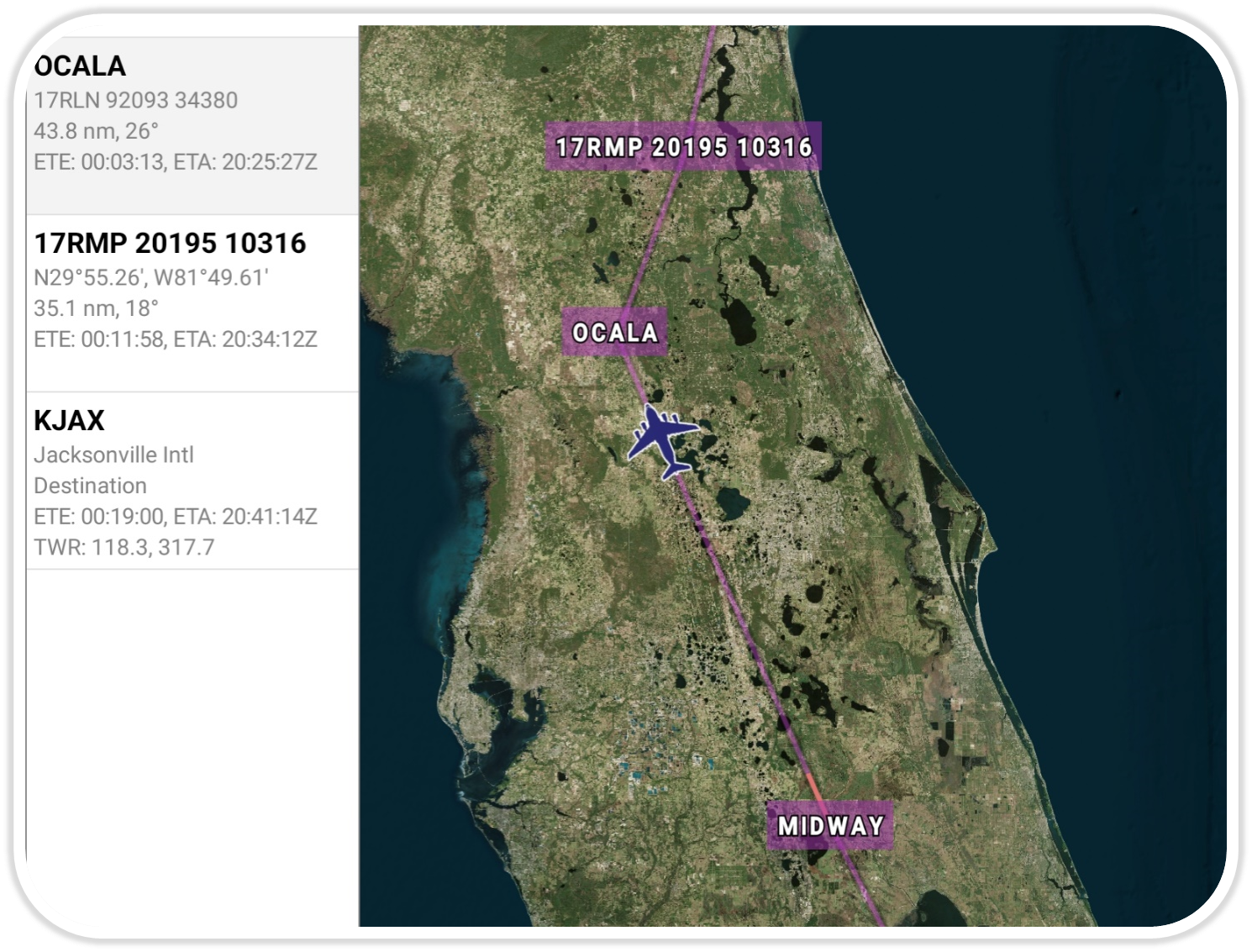
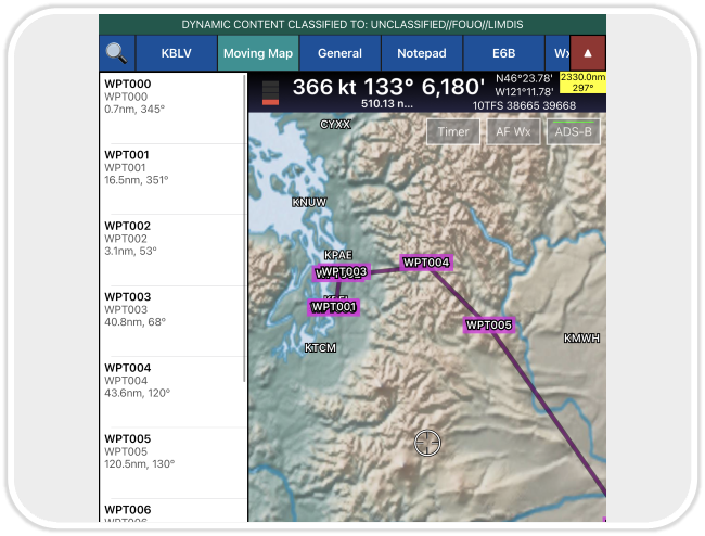
Display Routes
Aero App displays the individual route legs of Departure Procedures (DPs), Standard Terminal Arrival Routes (STARs), Instrument Approach Procedures (IAPs), Airways, and Jetways. The point information includes ICAO codes, frequency information (when appropriate), as well as distance, bearing, Estimated Time Enroute (ETE) and Estimated Time of Arrival (ETA) to the next point in the route. Aero App calculates the Cross Track (XTK) as the vehicle deviates from the route.
(Available on iOS, Android and Windows)
Georeferenced Charts
Georeferenced Approach Charts fit seamlessly into the moving map. Aero App uses comprehensive and accurate georeferencing data for the most accurate aircraft positioning possible.
(Available on iOS, Android and Windows)